

Sensitive mapping
Dernière mise à jour : 28 nov. 2025
Our map is not, per se, a sensitive one. Nevertheless, we drew inspiration from the sensitive mapping world to create this one. That is why the American continent you see on there is not "geographically accurate". Notre carte n'est pas, en soi, une carte sensible. Néanmoins, nous nous sommes inspirées du milieu de la cartographie sensible pour la créer. C'est pourquoi le continent Américain que vous pouvez y voir n'est pas "juste" selon les règles classiques de la géographie.

What is sensitive mapping?
Qu'est-ce que la cartographie sensible ?
"Sensorial mapping is a methodological tool developed within the domain of human geography in an effort to account for subjective forms of space perception. It is thought of as an alternative to modalities of objectivizing representations of space. Sensorial mapping favors an embodied approach, situated within the perceiving body; its meaning emerges from research informed by visual arts practices. Due to their subjective nature, sensorial maps are frequently the result of creative work in participation with the actors native to the field in question."
"La cartographie sensorielle est un outil méthodologique développé dans le domaine de la géographie humaine afin de rendre compte des formes subjectives de perception de l'espace. Elle est considérée comme une alternative aux modalités d'objectivation des représentations de l'espace. La cartographie sensorielle privilégie une approche incarnée, située dans le corps percevant ; sa signification émerge de recherches inspirées des pratiques des arts visuels. En raison de leur nature subjective, les cartes sensorielles sont souvent le résultat d'un travail créatif mené en collaboration avec les acteurs locaux du domaine concerné."
“Sensitive mapping”, Performascope: Interdisciplinary Lexicon of Performance and Research-Creation, Grenoble: Université Grenoble Alpes, 2021, [online]: http://performascope.univ-grenoble-alpes.fr/en/detail/177603
Drawing inspiration from sensitive mapping
S'inspirer de la cartographie sensible
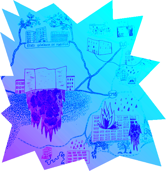
What inspired us in sensitive mapping is, on one hand, the pleasing, aesthetic possibilities that it enables. We wanted to create an object that people would want to look at closely, a map that could be easily apprehended by people, regardless of their background, language, or available time. On the other hand, we wanted to create an object with a meaning, which would be central in its construction.
We wanted that map to hold a political statement, depicting the impact of colonialism in America as well as the responsibility archaeology holds in documenting these periods. Thus, the geographical laws and norms are not defining the map's appearance, but the sites represented do. They outline the continent and its history. Nevertheless we, as European students, did not experience these sites, nor these lands, nor the policies held upon indigenous communities by the settler states of nowadays America.
Even though this projects aims to counterpoint a classical archaeological approach, we still relied on academic resources. That is why this cannot be considered a sensitive map — but an alternative, artistic, archaeological map.
Ce qui nous a inspiré dans la cartographie sensible est, d'une part, les possibilités esthétiques permises par cet outil. Nous voulions créer un objet que les gens désireraient regarder en détails, une carte qui pourrait être facilement appréhendée par n'importe qui, peu importe son parcours, sa langue ou son temps disponible. D'une autre part, nous souhaitions créer un objet qui aurait du sens — un sens qui serait central dans la construction dudit objet.
Nous voulions que cette carte soit porteuse d'un message politique, qu'elle dépeigne l'impact du colonialisme en Amérique, ainsi que la responsabilité qu'a l'archéologie de documenter ces périodes. C'est pourquoi les normes et lois géographiques ne définissent pas l'apparence de la carte, ce sont les sites archéologiques qui le font. Ils dessinent les contours du continent et son histoire. Toutefois, en tant qu'étudiantes européennes, nous n'avons pas fait l'expérience directe de ces sites, ni de ces terres, ni des politiques imposées aux communautés autochtones par les Etats coloniaux de l'Amérique actuelle.
Bien que ce projet vise à contrebalancer une approche archéologique classique, nous avons travaillé à partir de ressources universitaires. C'est pourquoi on ne peut considérer avoir réalisé une carte sensible — mais une carte archéologique alternative et artistique.
To go further...
Pour aller plus loin...
Indigenous cartography shares with sensitive mapping the idea of re-centering one’s experience of space in the cartography process. It values indigenous points of view and participate in theorizing colonial and European mapping as a tool for domination. For these reasons, we wanted to include into this websites some references allowing those interested to go further on this topic. La cartographie autochtone partage, avec la cartographie sensible, l'idée de recentrer l'expérience individuelle de l'espace dans le processus cartographique. Elle met en avant les points de vue autochtones et participe à la théorisation de la cartographie coloniale et européenne comme un outil de la domination. Pour ces raisons, nous voulions inclure dans ce site quelques références, pour permettre aux personnes interéssées par ce sujet d'aller plus loin.
Journal issues about Indigenous cartography. Numéros de revues sur la cartographie autochtone :
"Contre-cartographies, (Contre-)cartographies amérindiennes", Dossier thématique, IdeAs. Idées d'Amériques, Institut des Amériques, Vol.56, 2025.
"Special Issue on Decolonizing the Map", Cartographica, Vol.55(3), University of Toronto Press, 2020. URL : https://utppublishing.com/toc/cart/55/3
Journal articles. Articles de revues :
Breda, Thiara Vichiato (2022). (Of) Indigenous Maps in the Amazon: For a Decolonial Cartography. ISPRS International Journal of Geo-Information, Vol.11(3), 161.
Louis, Renee M. Pualani (2023). Indigenous cartographies and mapping abundance. Environment and Planning F, Vol.2(1-2), 322-327.
URL : https://doi-org.ezpaarse.univ-paris1.fr/10.1177/26349825231168864
Lucchesi, Annita Hetoevėhotohke'e (2018). ‘Indians Don't Make Maps’ : Indigenous Cartographic Traditions and Innovations, American Indian Culture and Research Journal, Vol. 42(3) pp. 11-26.
URL : https://escholarship.org/content/qt3fg38946/qt3fg38946.pdf?t=rzjb77
Other. Autre:
The Indigenous Mapping Collective website.
Finally, it may be interesting to some of you to look at the following article, that presents a collaborative approach to mapping, echoing with the collaborative approach in archaeology. Enfin, certain·e·s pourront être intéressé·e·s par l'article suivant, qui présente une approche collaborative de la cartographie, faisant écho à l'archéologie collaborative.
Sletto, Bjørn, Gerónimo Barrera de la Torre, Alexandra Magaly Lamina Luguana, & Davi Pereira Júnior (2021). Walking, knowing, and the limits of the map: performing participatory cartographies in Indigenous landscapes. Cultural Geographies, Vol.28(4), 611-627.
URL : https://doi-org.ezpaarse.univ-paris1.fr/10.1177/14744740211034479


